This feature of Map Builder enables
you to visualize a map area in 3D to facilitate your understanding
of the landscape. When you select a specific area of the map in the
Map View, this area is automatically displayed in 3D in its own pane
at the bottom of the Map Builder main window.
You can create more than one 3D View on the same map. With simple
mouse movements or using the interactors on the right, you can easily
navigate in the 3D View, zooming in or out or moving left to right.
3D Views can be draped with maps displayed in 2D views
and symbols can also be added and displayed.
You can use this information to study the terrain of
interest from all angles and tilts and so better determine points
of attack or defense by identifying potential hazards in the terrain.
You can enlarge the 3D View, make it smaller, move its position in
the view, rotate it through 360 degrees, and change the tilt from
top to side view in the same operation. You can also use an exaggeration
factor to increase or decrease the elevation data display. Visually
this is very useful when the distance represented by the 3D View is
great and the elevation of the terrain is quite low.
You can also display the 3D View in Wireframe mode, which
helps in understanding the geometry, given that areas of light and
shadow are not displayed. In addition, a refresh of the display can
be set such that it is only carried out when a change takes place
in the 3D View, thus reducing the CPU usage.
Symbols (2-dimensional) can be added to a 3D View and
managed. For more information, see Symbols in a 3D View and Managing Symbols.
The following figure shows an example of a 3D View.
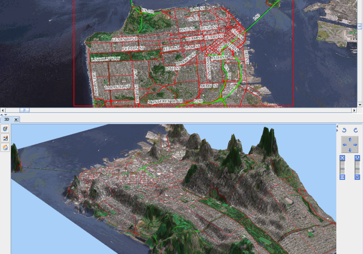
3D View
For more information about 3D Views and how to set their
properties, see Creating a 3D View.