This Fly Through feature enables you to define a path
to be followed during the assault on a given target and study, in
3D, the effects that the terrain could have on such an attack. You
could, for example, simulate an approach for ground vehicles, foot
soldiers, or for fighter planes that fly close to the ground. Or you
could create your own scenario using the API. You have full control
over the camera placement and the direction in which it is looking.
The API has been designed to specify an altitude for
each of the trajectory points and a view point, and can also use a
customer-written interpolation method between the points. In addition,
you can specify the speed and altitude above ground by changing the
style of the map layer containing the Fly Through.
The Fly Through function makes it a simple task to simulate
movements in a 3D View.
The operations that you can carry out on the trajectory
(polyline) and 3D View are the same as those described in 3D View.
The following figure shows an example of the 2D Fly
Through pane.
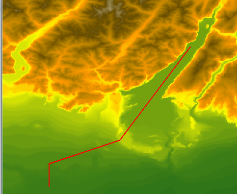
The 2D Fly Through pane
The following figure shows an example of the 3D Fly
Through pane.
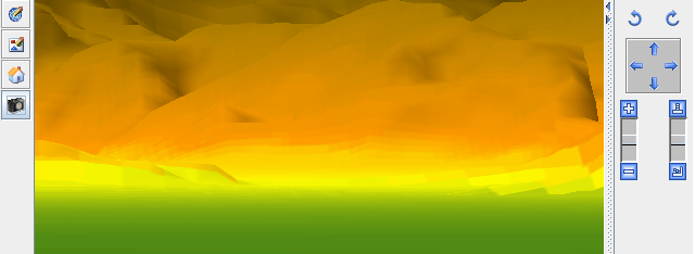
The 3D Fly Through pane
For more information about Fly Through paths and how
to set their properties, see Creating a Fly Through.