This terrain cut feature of Map Builder enables you to draw a polyline in a map. When you
draw the polyline, the corresponding terrain elevation data is automatically
displayed in its own pane at the bottom of the Map Builder main window. You can create more than one terrain
cut on the same map.
You can use this information to study more complex ways
of approaching a given target or to set up a particular defense strategy.
This could represent, for example, an attempt at encirclement or a
two-pronged attack on a given target. The coordinates of the line
of view are displayed in the pane, which presents distance along the x axis and height along the y axis.
The following figure shows an example of a terrain cut
with the corresponding elevation data and x,y coordinates
displayed.
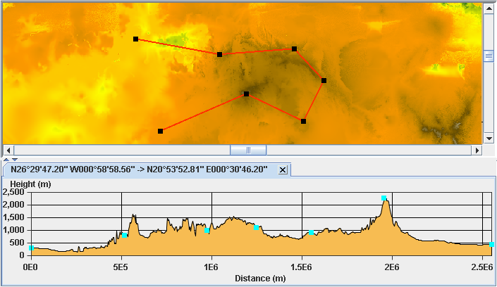
Elevation data along a terrain cut
You can select the polyline as a unit and move it on
the map, or select one of the nodes and change the shape of the polyline;
the terrain elevation data is updated accordingly. You can also add
or remove points to or from the polyline using the the CTRL key and a mouse click. The nodes
in the elevation data correspond to the nodes in the polyline.
For more information about Terrain Cuts and how to set
their properties, see Creating a Terrain Cut.