The Line of Sight feature enables you to draw a particular
Line of Sight in a map. The line drawn is color-coded according to
the elevation of the terrain. The color coding indicates whether a
particular point on the line is visible from the point of origin or
not. When you draw the line, the corresponding terrain elevation data
is automatically displayed in its own pane at the bottom of the Map Builder main window. You can create more than one line of
site on the same map.
You can use this information to study different ways
of approaching a given target or to set up a particular defense strategy.
The coordinates of the line of view are displayed in the pane, which
presents distance along the x axis
and height along the y axis.
The following figure shows an example of a map with a
Line of Sight drawn and the corresponding terrain elevation data displayed.
.
Note
This is an example only and the computation is performed
using “classic” 3D algorithms. However, if you want
to use radar coverage and include weather and fog in computations,
you can do so using the API.
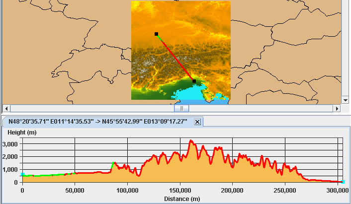
Elevation data along a Line of Sight
For more information about Lines of Sight and how to
set their properties, see Creating a Line of Sight.