An Area of Sight can be shown as a circular area around
the mouse position on the map. The Area of Sight reveals an approximation
of the elevation data within the circle and changes as the mouse is
moved around the map.
The following figure shows an example of an Area of Sight.
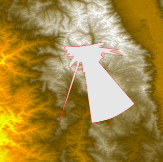
Area of Sight approximation
When you click the mouse button the Area of Sight at
this point is saved and the Area of Sight Style Setting window appears
for you to set the properties you want. When you have set the properties,
a detailed computation of the visible and invisible areas is carried
out and displayed in the Map View as a raster image.
The following figure shows an example of an Area of Sight
with detailed computations.
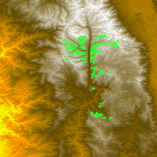
Detailed Area of Sight computation
The point around which the computation is done is displayed
in the center of the Area of Sight (you may have to zoom in to see
it). A new Area of Sight layer is created and displayed in the Map
Layers pane each time you carry out an Area of Sight computation.
You can change the colors used to display the visible
and invisible parts of the terrain, increase or decrease the precision
of the terrain display, and change the point of view height to view
the terrain either at ground level or at a given altitude.
For more information about Area of Sight computations
and how to set their properties, see Creating an area of sight.