The class diagram for the mid/mif reader is shown in MID/MIF Reader UML Diagram.
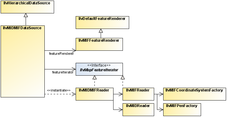
MID/MIF Reader UML Diagram
This section describes the ilog.views.maps.format.midmif package, which allows you
to read files provided in the MapInfo Interchange File (MIF) format.
A MapInfo Interchange Format consists of a MIF file containing the geometries and rendering attributes,
and a MID file containing the attributes attached to each geometry.
The MIF file is an ASCII text file that describes the
geometry data associated with rendering attributes such as pen and
brush styles, font, and color that should be used to transform geometries
into graphic objects. The reader classes provided with the JViews Maps package allow you to use either the
information contained in the MIF file or your own rendering attributes.
The MID file contains attributes, which are nongraphical
additional information associated with the geometries contained in
the MIF file.
The MID/MIF Reader contains the following classes: