If the data source is a DAFIF file, there are a number
of other parameters that you can set.
The following figure shows the options available when
importing a DAFIF file.
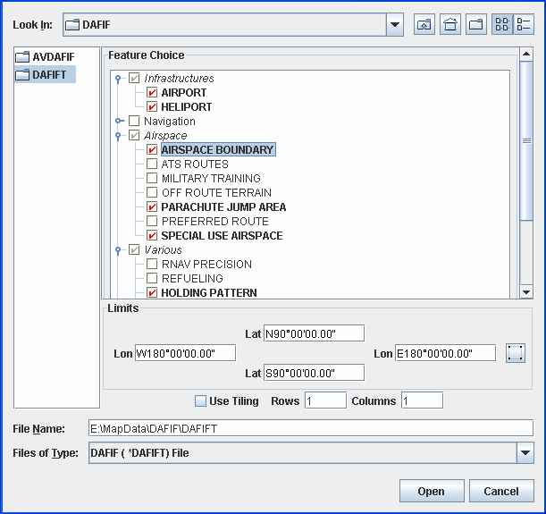
Select Data Sources pane for a DAFIF file
-
Choose File>Add Map Data to display the Select Data Sources pane.
-
Select the DAFIF file you want to open.
-
In the Feature Choice pane, click each of the features you want to display in the DAFIF data source. Note that you can expand a feature and select one or more of its subfeatures.
-
In the Limits pane, set the limits manually for the
Lat/Lonproperties or click the button and then draw a rectangle in the
Map View to set the limits.
button and then draw a rectangle in the
Map View to set the limits. -
Select Use Tiling, if you want to use this option, and set the number of rows and columns.
-
Click Open.