If the data source is a DB2® spatial
database, there are specific parameters that you can set.
The following figure shows the options
available when importing from a DB2 spatial database.
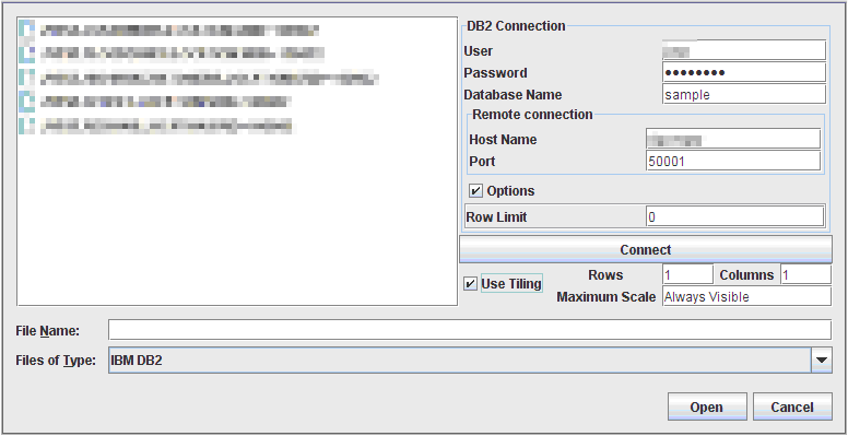
Select Data Sources pane for a DB2
spatial database
To import layers from a DB2 spatial
database:
-
Select File>Add Map Data to display the Select Data Sources pane.
-
Choose IBM DB2 in the Files of Type list.
-
Enter the parameters to create a connection to the database. You need a login and a password for the Host machine hosting the database. You will also need the port number and the name of the database.
-
Optionally, if the size of the database is very large, you can specify a Row limit that will limit the number of elements JViews Maps requests from the database at one time. Enter 0 to deactivate that mechanism.
-
Click Connect.
-
If you intend to load data on demand, enable Use Tiling, then specify the column and line count defining the tiling.
-
If you activate tiling, you also have the possibility to specify a maximum scale at which the data will be visible. This will allow you to request the data from the database only when the map sufficiently zoomed. For example, if you enter 1000000, the data will be loaded only if your map is zoomed more than 1/1000,000.
-
Select your table (or tables) and click Open to perform data loading.NoteThis feature relies on the DB2 JDBC driver that is installed along with JViews Maps. Please make sure that your DB2 server has a compatible version. See Requirements for Rogue Wave JViews Maps .