The surface of the Earth is complex, even if the topography
is removed so that only the geoid (the
gravity surface approximating to mean sea level) is taken as the shape
of the Earth. In fact, because of Earth’s internal composition,
which leads to local gravity anomalies, the geoid is very irregular.
Therefore, the most widely used model of the Earth approximates the
geoid to an oblate ellipsoid (the spheroid), or even simpler, a sphere.
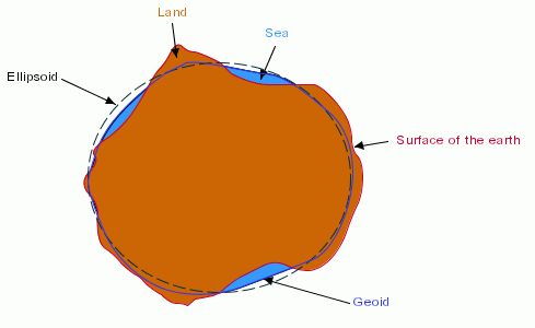
Model of the earth
Of course since the use of an ellipsoid is an approximation,
there is no universal ellipsoid that fits the geoid everywhere. For
a given location, the best fitting ellipsoid can have different dimensions
compared to other locations. That is why a large number of ellipsoids
are used in maps.
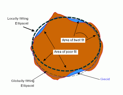
Area of best fit
Defining an ellipsoid is not sufficient. It is also necessary
to define the spatial relationship (position and orientation) between
the ellipsoid and the geoid. This is achieved through the definition
of a geodetic datum, or horizontal datum, giving the position and
the orientation of the ellipsoid relative to the center of the Earth.