The following figure shows the class relationship for
a CADRG Reader.
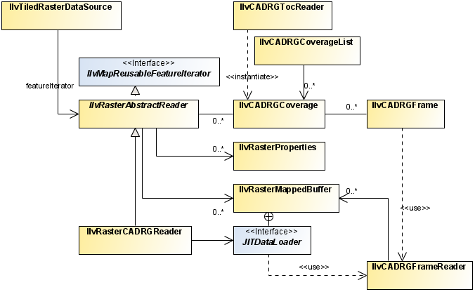
CADRG reader UML diagram
This package contains classes for reading Compressed
ARC Digitized Raster Graphics (CADRG) files. The CADRG format is a map format for scanned maps published
by the US National Imagery and Mapping Agency (NIMA). The CADRG readers
provided by JViews Maps for Defense are based on specification document MIL-C-89038 October 6th, 1994. Note
that CADRG data is available on the maps data DVD supplied with the
installers for JViews Maps for Defense.
To automatically read a CADRG coverage using the Rogue Wave® JViews load-on-demand
mechanism, you can use an IlvCADRGLayer. A CADRG database covers an area with scanned maps
of various scales. It is composed of:
- A root directory (generally called the
rpfdirectory) that contains a table of contents file, calledA.TOCthat can be read using an IlvCADRGTocReader. - One or more subdirectories, each corresponding to a specific coverage. These subdirectories contain the CADRG frames that make up the coverage. A complete CADRG frame is made up of 36 subframes, 6 by 6. Generally CADRG coverages are in the geographic projection except for the poles, for which the azimuthal equidistant projection is more appropriate. These subdirectories contain the CADRG frames that make up the coverage and can be read using an IlvCADRGFrameReader.
- Other general information, such as overviews of the area represented in the coverage, and one or more legend files.
The CADRG structure is particularly suited to load-on-demand
and allows you to select the coverage that is best adapted to a given
display scale.
The source code for the Map Builder demonstration,
which contains all of the code described in this section, can be found
at
<installdir>
/jviews-maps89/samples/mapbuilder/index.html