If the data source is an Oracle®
spatial database, there
are specific parameters that you can set.
The following figure shows the options available when
importing from an Oracle Spatial database.
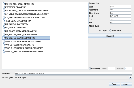
Select Data Sources pane for an Oracle spatial database
To import layers from an Oracle Spatial database:
-
Choose File>Add Map Data to display the Select Data Sources pane.
-
Choose Oracle Layer in the Files of Type list.
-
Enter the parameters to create a connection to the database. You need a login and a password for the Host machine hosting the database. You will also need the port number and the Spatial ID of the database, that is, the "name" of the database.
-
Select the model type of your database. In recent Oracle spatial databases, object model is the standard.
-
Click Connect.
-
If you intend to load data on demand, enable Use Tiling, then specify the column and line count defining the tiling.
-
Click Open to perform data loading.
Note
before using this functionality, you must install an
Oracle driver to be able to import Oracle layers within the Map Builder. For information on how to do this, refer to Importing
Oracle Layers within Map Builder in the
help file found at
<installdir>
/jviews-maps89/samples/mapbuilder/index.html.