The class diagram for the Oracle®
spatial reader and writer is shown in Oracle Spatial Reader and Writer UML Diagram.
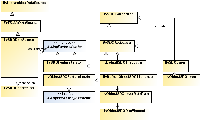
Oracle Spatial Reader and Writer UML
Diagram
Oracle SDO, or Oracle Spatial, is the spatial extension of
Oracle in its version 7.3. This extension has been renamed to
Spatial Cartridge in the version 8.0 and has been renamed again to
Oracle Spatial in the version 8i.
The classes are based on the relational implementation of Oracle
Spatial available since Oracle 7.3. It contains classes that
facilitate the use of map data (stored in an Oracle database) in an
Rogue Wave® JViews application. Oracle
Spatial allows you to store georeferenced objects in an Oracle
database and to perform spatial queries, such as getting the list
of objects that intersect a specific polygon.
Oracle has written two implementations of
Oracle Spatial:
- An implementation based on relational tables, available since Oracle 7.3.
- An implementation based on the Object Relational model, available since Oracle 8i, which also contains the relational implementation of Oracle Spatial.
The Oracle reader of JViews
Maps supports reading and writing data in the relational and the
object relational model of Oracle Spatial through two different
packages:
- The package ilog.views.maps.format.oracle contains classes to read and write Oracle Spatial Relational model.
- The package ilog.views.maps.format.oracle.objectmodel contains classes to read and write Oracle Spatial Object Relational model.
The Oracle Spatial Reader and Writer
comprises the following classes:
The complete source code for an Oracle Reader demonstration can be
found at <installdir> /jviews-maps810/samples/oracle/index.html.