Data sources can be of several types. Some
data sources provide only a simple map backdrop, while others can
provide details down to street level, describe water facilities,
transport facilities, and so on. Normally, one data source is
equivalent to one map data file or one database query. However,
when reading multiresolution maps such as CADRG, there is one data
source per resolution.
The Data Sources pane (if this tab is not visible see Additional views) provides a list of all the
data sources currently imported into the Map Builder and their
corresponding properties. Typically the properties define the
coordinate system applied to the data source and the name of the
file in which the data is held. The complete set of properties in
the list depends on the type of data source selected.
You can select a data source in the list,
change its properties at any time, or remove it from the list.
The following figure shows an example of the
Data Sources pane.
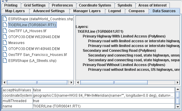
Data Sources pane
For information about how to use the Data Sources pane, see Using the Data Sources pane and for
information about how to import a data source, see Importing
a simple data source.