You can set your map coordinate system using
one of two ways:
- using the Coordinate system tab tab
- using the Predefined Coordinate System pane pane
Coordinate system tab
The coordinate system enables you to set the type of projection
that you want to apply to your map and the projection properties.
The current projection is displayed in a pane in the Map Builder
under the Coordinate System tab. You
can change the projection at anytime.
For example, you may want to display your maps using the UTM
Zone6 coordinate system, which is a transverse mercator
projection centered at 147˚W, with a false easting, and which
uses the GRS80 ellipsoid and North American 1983 (CONUS) datum.
These parameters are available by selecting the Advanced settings in the Coordinate System
pane.
A coordinate system is presented as a
projection and parameters, plus its datum and ellipsoid as shown
in the following figure.
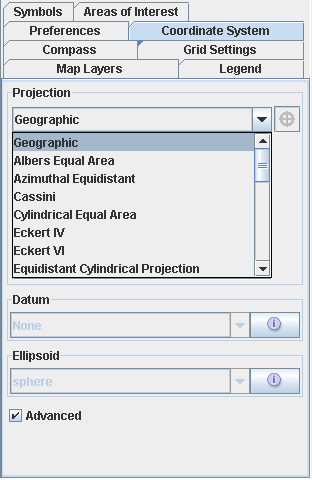
Coordinate System pane
Predefined Coordinate System pane
The Predefined Coordinate Systems pane (choose Options>Predefined Coordinate Systems
to display this pane) lists all the known systems and settings
that are normally used. The list is built on an historical and
country basis. The Predefined Coordinate Systems pane also
provides a preview of the selected coordinate system. Note that
when you set the coordinate system from this pane, it is
automatically updated in the Coordinate System pane.
The following figure shows an example of a
Predefined Coordinate System pane.
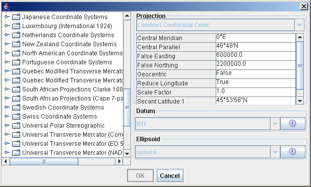
Predefined Coordinate System pane
For more information, see Setting coordinate systems.