Zooming in on California
-
Click the
 button on the
toolbar and draw a rectangle around the California area to
zoom in on it. If necessary, zoom in again to enlarge the
map more.
button on the
toolbar and draw a rectangle around the California area to
zoom in on it. If necessary, zoom in again to enlarge the
map more.
Adding altitude information
-
Choose File>Add Map Data to open the file browser, select the GTOPO30-DEM format, and then select the drive where you downloaded and saved your data. For example, select the data source
W140N40.DEM, and then choose Open.The following figure shows the resulting Map View pane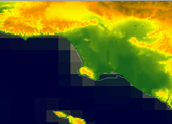 The Data Source GTOPO30-DEM W140N40-DEM
 -
Select the Preferences tab and set the
Distancesproperty to International Statute Mile, theAltitudesproperty to International Foot, and theCoordinatesproperty to UTM. -
Select the Map Layers tab to redisplay the pane and then click the
 button to display
the whole map in the Map View pane.
The following figure shows the resulting Map View pane.
button to display
the whole map in the Map View pane.
The following figure shows the resulting Map View pane.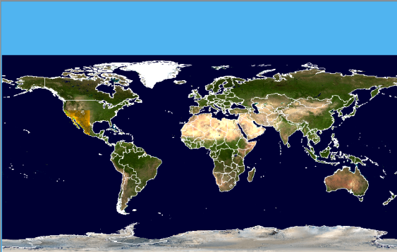 The data source GTOPO30-DEM W140N40-DEM