The IlvMapAreaRenderer and IlvMapCurveRenderer provide a geodetic
computation option. Geodetic computation includes date line
wrapping and reprojection of features that go outside of the
projection limits.
To create a renderer that performs geodetic computations, just pass
true
to the specified argument:
IlvShapeDataSource ds = new IlvShapeDataSource(shapeFile);
ds.setManager(view.getManager());
// perform geodetic computations
IlvMapAreaRenderer renderer = new IlvMapAreaRenderer(false, true);
ds.setFeatureRenderer(renderer);
The figures show geodetic computation with
and without date line wrapping:
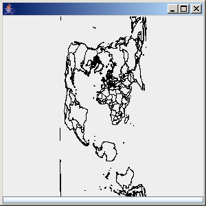
Geodetic computation with date line
wrapping
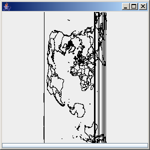
Geodetic computation without date line
wrapping