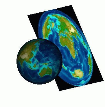
A map is a projected representation of the
Earth, or part of it, on a flat surface, which can be a piece of
paper or a computer screen. Since the Earth has an ellipsoidal
shape, it is best represented as a “globe”, and attempts to portray
it by projecting its points onto a flat surface always result in
some form of distortion in the regions that are far from the
projection center. In other words, it is impossible to faithfully
represent all the properties of the Earth, such as distances,
shapes, and directions, on the same map. To minimize distortion,
many different types of projections have been developed over the
years. While certain projections preserve distances, others
maintain shapes or angles. When creating a map, you have to choose
the projection system that is best suited to the area to be
represented or to the particular interests that your map
application is designed for.
Projections can be classified into three
main categories:
Projections can also be:
Cylindrical projections
A cylindrical projection is obtained by
wrapping a large, flat plane around the globe to form a cylinder.
In the following figure, the cylinder is tangential to the
equator. The closer the zone of tangency the less the distortion.
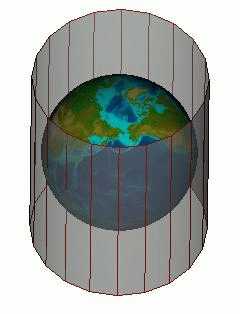
A cylindrical projection (1)
The position of the cylinder can be
changed. For example, in a transverse cylindrical projection, the
cylinder is tangential to a meridian.
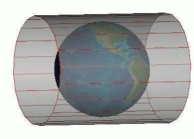
A cylindrical projection (2)
Conic projections
A conic projection transfers the image of
the globe to a cone that forms either a secant or a tangent with
the surface of the Earth.
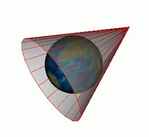
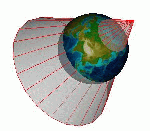
Examples of conic projections
Azimuthal projections
With azimuthal projections, also called
planar projections, the spherical globe is projected onto a flat
surface.
An azimuthal projection
Equal area or conformal projections
All map projections show some kind of
distortion in the areas that are far from the projection center.
Depending on the kind of projection used, the distortion may be
of angle, area, shape, size, distance, or scale. In this respect,
projections fall into two main categories, Equal Area and
Conformal.
- Equal area projections maintain a true ratio between the various areas represented on the map.
- Conformal projections preserve angles, and locally also preserve shapes.
Other projections have properties that are
worth noting, such as maintaining the distances measured from the
center of the projection (azimuthal equidistant projection).
Others offer a good compromise between angular distortion and
distortion of the area.
Projections should therefore be configured
and selected according to the areas to be represented (for
example, it is impossible to represent the polar regions with the
Mercator projection) and the domains they apply to (navigational
or air-route applications, small-scale or large-scale maps, and
so on). Navigational applications, for example, generally use
conformal projections.
For more information on map projections,
refer to these books:
- Map Projections - A Working Manual (Snyder, 1987)
- An Album of Map Projections (Snyder and Voxland, 1989)