If the data source is an ESRI/Shape (
.shp
) file, there are additional options that you can use.
The following figure shows both the Advanced
and Select Projection options selected.
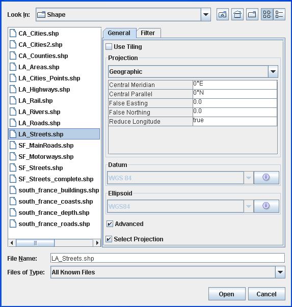
Select data sources pane for ESRI/Shape
file
-
Choose File>Add Map Data to display the Select Data Sources pane.
-
Select Use Tiling, if you want to have an additional index file (
.idx) managing the shape file using a load on demand algorithm. If the index file does not exist, the Create index file pane asks you if you want to create a new one. -
To create a new index file, click Yes to display the Tiling parameters pane and enter the parameters you want.The following figure shows the Tiling parameters pane.
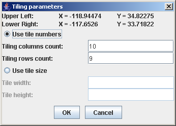 Tiling parameters pane
 -
If you want to set projection parameters, see Setting coordinate systems.
-
If your shape file has an associated dbf (database) file and thus contains metadata, you can use this to filter so that you load only a subset of the file content. To do this, select the Filter tab, select the Activate Filter check box and define your filter by selecting items from the drop-down lists.The following figure shows the definition of a filter which will only load San Francisco streets which have ZIP codes greater than “92000”.
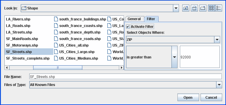 Filter definition to load only a subset of the shape file content
 -
Click Open.