- java.lang.Object
-
- ilog.views.maps.format.dted.IlvDTEDReader
-
- All Implemented Interfaces:
- IlvMapFeatureIterator
public class IlvDTEDReader
extends Object
implements IlvMapFeatureIterator
This class can be used to read DTED files.
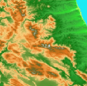
The Digital Terrain Elevation Data (DTED) format is a map format for representing terrain elevations, which is published by the US National Imagery and Mapping Agency (NIMA).This reader produces only one map feature which is an
IlvMapRaster.The DTED reader provided in this package is based on the specification document MIL-PRF-89020A of 19 April 1996.
DTED files are available with various precision levels: DTED0, DTED1 and DTED2, with DTED2 offering the greatest precision.

- Since:
- Rogue Wave JViews 3.0, Rogue Wave JViews 3.0
- See Also:
IlvMapRaster,IlvDefaultRasterRenderer
-
-
Constructor Summary
Constructors Constructor and Description IlvDTEDReader(DataInput dataInput)Creates an instance of the DTED reader from aDataInput.IlvDTEDReader(String fileName)Creates an instance of the DTED reader for the specified file name.IlvDTEDReader(URL url)Creates an instance of the DTED reader for the specified URL.
-
Method Summary
All Methods Instance Methods Concrete Methods Modifier and Type Method and Description voiddispose()Releases the resources allocated to the reader.voidfinalize()Is called by the Java Garbage Collector to release the resources allocated to the reader.protected intgetColumnCount()Returns the number of columns of the data.IlvCoordinateSystemgetCoordinateSystem()Returns the spatial reference system that describes the coordinate system of geometric coordinates of the map features.IlvFeatureRenderergetDefaultFeatureRenderer()Returns an instance ofIlvDefaultFeatureRenderer.IlvCoordinategetLowerRightCorner()Returns the coordinates of the lower-right corner of the DTED raster image.shortgetMaxElevation()Returns the highest elevation.shortgetMinElevation()Returns the lowest elevation.IlvMapFeaturegetNextFeature()Returns the raster of elevations.protected intgetRowCount()Returns the number of rows of the data.IlvCoordinategetUpperLeftCorner()Returns the coordinates of the upper-left corner of the DTED raster image.booleanisGeoreferenced()Returnstruebecause this format is a georeferenced format.
-
-
-
Constructor Detail
-
IlvDTEDReader
public IlvDTEDReader(String fileName)
              throws IOException,
                     IlvMapFormatException,
                     FileNotFoundException
Creates an instance of the DTED reader for the specified file name.- Parameters:
fileName- The name of the DTED file to be read.- Throws:
FileNotFoundException- if the file does not exist.IlvMapFormatException- if there is a format error.IOException- if an IO error occurs.
-
IlvDTEDReader
public IlvDTEDReader(URL url)
              throws IOException,
                     IlvMapFormatException
Creates an instance of the DTED reader for the specified URL.- Parameters:
url- The URL of the DTED file to be read.- Throws:
IlvMapFormatException- if there is a format error.IOException- if an IO error occurs.
-
IlvDTEDReader
public IlvDTEDReader(DataInput dataInput)
              throws IOException,
                     IlvMapFormatException
Creates an instance of the DTED reader from aDataInput.- Parameters:
dataInput- A data input opened on a DTED file.- Throws:
IlvMapFormatException- if there is a format error.IOException- if an IO error occurs.
-
-
Method Detail
-
getMaxElevation
public short getMaxElevation()
Returns the highest elevation.
-
getMinElevation
public short getMinElevation()
Returns the lowest elevation.
-
getColumnCount
protected int getColumnCount()
Returns the number of columns of the data.- Returns:
- Returns the number of columns of the data.
- Since:
- JViews 7.5
-
getRowCount
protected int getRowCount()
Returns the number of rows of the data.- Returns:
- Returns the number of rows of the data.
- Since:
- JViews 7.5
-
dispose
public void dispose()
Releases the resources allocated to the reader. This method can be called several times, but only the first call actually frees the allocated resources.- Specified by:
disposein interfaceIlvMapFeatureIterator
-
finalize
public void finalize()
Is called by the Java Garbage Collector to release the resources allocated to the reader. If thedisposemethod has not been called, it releases the resources used by the reader.
-
isGeoreferenced
public boolean isGeoreferenced()
Returnstruebecause this format is a georeferenced format.- Specified by:
isGeoreferencedin interfaceIlvMapFeatureIterator
-
getCoordinateSystem
public IlvCoordinateSystem getCoordinateSystem()
Returns the spatial reference system that describes the coordinate system of geometric coordinates of the map features.- Specified by:
getCoordinateSystemin interfaceIlvMapFeatureIterator- Returns:
- The coordinate system, or
nullif the coordinate system is unknown. - Since:
- JViews 5.0
-
getUpperLeftCorner
public IlvCoordinate getUpperLeftCorner()
Returns the coordinates of the upper-left corner of the DTED raster image. These coordinates are expressed in the geographic projection.- Specified by:
getUpperLeftCornerin interfaceIlvMapFeatureIterator
-
getLowerRightCorner
public IlvCoordinate getLowerRightCorner()
Returns the coordinates of the lower-right corner of the DTED raster image. These coordinates are expressed in the geographic projection.- Specified by:
getLowerRightCornerin interfaceIlvMapFeatureIterator
-
getNextFeature
public IlvMapFeature getNextFeature()
                             throws IOException
Returns the raster of elevations. For the DTED reader, there is only one feature returned.- Specified by:
getNextFeaturein interfaceIlvMapFeatureIterator- Throws:
IOException- when an error occurs while reading the data.- See Also:
IlvMapRaster
-
getDefaultFeatureRenderer
public IlvFeatureRenderer getDefaultFeatureRenderer()
Returns an instance ofIlvDefaultFeatureRenderer.- Specified by:
getDefaultFeatureRendererin interfaceIlvMapFeatureIterator
-
-