Cartography
Introduces the cartographic concepts that any mapping product must address.

Presents the different categories of map.
Introduces and illustrates what a spatial reference system is.
Introduces and illustrates coordinate systems.
Presents and illustrates the different map projections.
Describes briefly map data formats and links to more detailed information about map formats.
What is a map?
In general, we all have experience of paper travel maps or electronic maps as found in Google Maps™ or Google Earth™. Unlike paper maps, electronic maps provide the ability to display the data you need, the way you need it.
There are three main categories of map:
Vectorial maps are a set of points, lines or areas and can contain additional data such as road names. You can decide on the look and feel of the display.
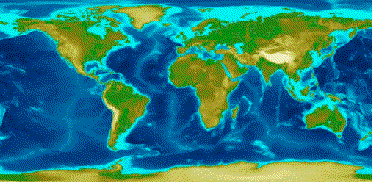
Raster maps as satellite views. These provide realistic views of the earth, but are often heavy and can be confusing.
Elevation maps that provide altitude information for any place on the globe.
All three categories can be mixed together in a single map display.
Spatial reference systems
Different reference systems exist, but georeferencing services encompass the spatial positioning of objects on the surface of the globe and the superimposition of data from different sources. They provide a framework for modeling the earth.
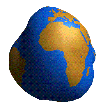
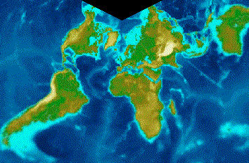
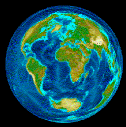
The earth used to be modeled as a sphere, but in reality it has an irregular shape and the modeling framework has to take into account the irregularities.
The earth modeled as an irregular shape
Coordinate systems
Real object coordinates can be expressed in different systems. The main systems are:
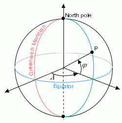
Geographic coordinate system
In a geographic coordinate system, latitude and longitude are used and are represented by two angles from the center of the earth:
Latitude = south to north +90 or 90N = north pole, -90 or 90S = south pole, and 0 is on the equator.
Longitude = east to west. 0 is in England.
An example of coordinates using the geographic: longitude and latitude with optional altitude is shown in
Geographic coordinate system.
Geographic coordinate system
In a geographic coordinate system the angular distance is expressed in degrees and minutes, for example, New York:
Latitude 40 Degrees 59'N
Longitude 73 Degrees 39'W
A geographic coordinate system is defined by:
The unit system of coordinates (angular unit and linear unit).
The prime meridian:
For example, the Greenwich meridian.
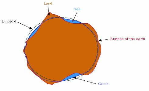
The horizontal datum:
A horizontal datum is used to represent the shape of the earth.
The datum is defined by an ellipsoid (the default is a sphere) and a translation of the ellipsoid (position of the ellipsoid relative to the center of the earth), see
Horizontal Datum:
Horizontal Datum
Geocentric coordinate system
An example of coordinates using the geocentric: three-axis Cartesian system with the center of the earth as the origin is shown in
Geocentric Coordinate System:
Geocentric Coordinate System
A three-axis Cartesian system is defined by:
Its origin, the center of the earth.
Its x-axis, which lies in the plane containing the equator and which is oriented towards the Greenwich meridian.
Its y-axis, which lies in the plane containing the equator and which is oriented towards the longitude 90 Degrees East of Greenwich.
Its z-axis, which corresponds to the polar axis and which is oriented northwards.
A geocentric coordinate system is defined by:
The unit system of coordinates (linear units) on the axes.
The horizontal datum.
Projected coordinate system
A projected coordinate system is a representation of the earth on a 2-D surface. Units are attached to each axis of a coordinate system. For example, for geographic coordinates:
x- and y-coordinates expressed in degrees
z-coordinate expressed in meters
A kernel unit is defined for each type of unit.
Length in meters
Angles in radians
Coordinate systems are used to display maps and a map projection is used to reduce the dimensions to two. A projected coordinate system is defined by:
The associated geographic coordinate system
The projection
The unit system of projected coordinates
Map projections
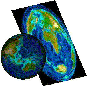
The Earth is a globe and displaying it on a plane requires complex mathematical transformations known as projections. Map projections are attempts to portray the surface of the earth or a portion of the earth on a flat surface. Some distortions of conformality, distance, direction, scale, and area always result from this process. Some projections minimize distortions in some of these properties at the expense of maximizing errors in others. Some projections are attempts to only moderately distort all of these properties. Map projections convert geographic points, represented by a longitude and a latitude, to Cartesian coordinates in a planar coordinate system.
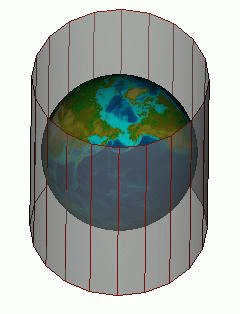
Cylindrical projections are precise around the equator
Cylindrical projection
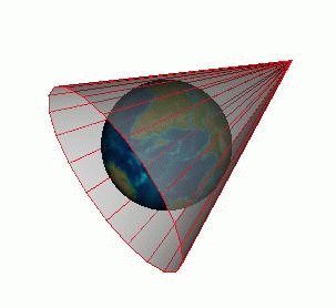
Conic projections are good for regions other than the equator
Conic projection
Azimuthal projections are used for regions around the Poles
Azimuthal projection
You use a particular projection depending on the area of the globe that interests you. Mercator preserves the heading and is useful for navigation. Lambert (conic) distorts distance. Lambert 1 is used for Northern France and Lambert 2 for Southern France.
Equidistant cylindrical projection
Lambert conformal conic projection
Lambert azimuthal equal area projection
The ideal characteristics for a projection would be:
Meridians and parallels crossing at right angles
Converging meridians
Equidistant parallels
The shortest distance between two points is represented by a straight line
Surface areas are represented by a constant ratio
Surface contours have an accurate representation
The whole projection is based on a uniform scale
The perfect projection does not exist, so you have to choose the best suited to your needs, depending on the main properties of your application and the geographic areas used in your application.
Map data formats
There are many types of map data formats that can be read into a map. Many of these are governed by cartographic Standards.
JViews Maps for Defense handles a large number of these formats. See
Data formats.
JViews Maps for Defense also allows you to import (read from) and export (write to...) specific raster, vector, and defense specific database formats.
Copyright © 2018, Rogue Wave Software, Inc. All Rights Reserved.