The S57 Map Reader
Rogue Wave Views Maps contains classes for reading S57 files. The S57 format is a numerical map format for nautical maps, which is a standard published by the International Hydrographic Organization (IHO). You can find more information at:
http://www.iho.shom.fr/
The S57 readers provided in this package are based on the IHO TRANSFER STANDARD FOR DIGITAL HYDROGRAPHIC DATA Edition 3.1.
The S57 Reader module provides access to data in IHO S57 formatted file sets. The S57 Reader module produces S57 features in one or more related S57 data files. An S57 dataset can be a directory, in which case all S57 files in the directory are selected, an S57 catalog file, in which case all files referred to from the catalog are selected, or an individual S57 data file. An S57 catalog covers an area with nautical data. It is composed of a single directory containing both a catalog file (.030 or .031) and cell files (.000). Usually cells contain data for only a subzone of the global catalog zone.
S57 feature objects are translated into features. S57 geometry objects are automatically collected and formed into geometries on the features.
S52 symbols are rendered using a predefined icon per object type, whatever the object attributes are.
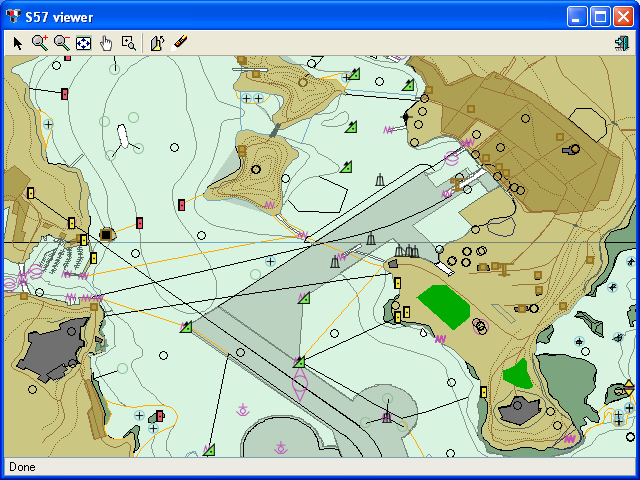
The default S57 Renderer, uses predefined styles to represent map features through polylines, polygons and small icons. A configuration file allows you to configure these styles. For example you can specify colors, line styles, icons and even visibility for each feature, based on its S57 code. You can also create your own implementation of the Renderer to display the same S57 data through a different formalism.
Figure 5.1 Example of S57 map rendering
Version 5.8
Copyright © 2014, Rogue Wave Software, Inc. All Rights Reserved.