Creating a Map
Note: This section assumes that you have downloaded appropriate data to your workstation. For a list of suggested free sources for downloading map data, see Map Data. This example uses ESRI Shapefile data. |
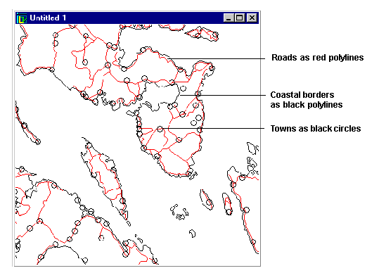
You may want to create a map of the Philippine Islands in the South Pacific and show its coastal borders, towns, and roads. You need map data which may come in the form of files or in the form of data requests from a cartographic server. In both cases the predefined readers of Rogue Wave® Views Map Builder allow you to easily load data from many different sources. Once the data is loaded into the Map Builder, you start working within the environment of Rogue Wave Views Maps.
In the first example you will use map data files.
Note: When loading the files into the Map Builder, you set various parameters for the information that will be loaded. These parameters, renderers, target projections and so on, are discussed in detail along with the different file formats in the following chapters. |
After loading the files, your map will appear as follows:
Figure 2.1 Map of the Philippines Islands
In this example, you will learn how to:

Load files with Rogue Wave Views Map Builder (Shapefiles in this example)
Choose a renderer
Use the scale filter
Display the attributes of an object
Edit your layer names
Save a Rogue Wave Views file
Version 5.8
Copyright © 2014, Rogue Wave Software, Inc. All Rights Reserved.